
Map Room
These maps of Freeport were created for the data inventory chapters in the Comprehensive Plan. Click on any map to view it enlarged.

Agriculture & Forestry - Current Use

Agriculture & Forestry - Prime Farmland

Existing Land Use

Historic Places & Design Review Districts - Downtown

Historic Place & Design Review Districts

Housing

Marine Resources & Habitats
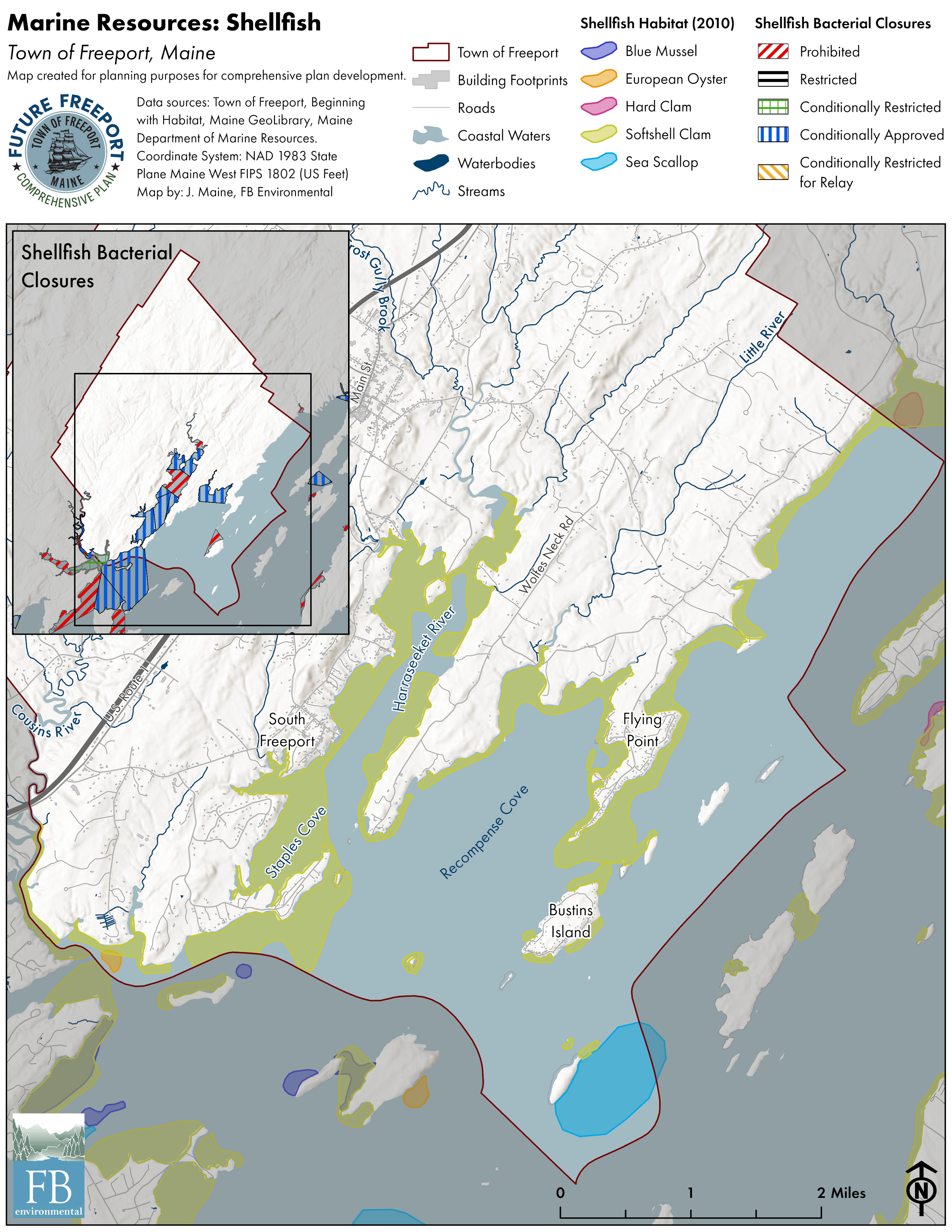
Marine Resources - Shellfish
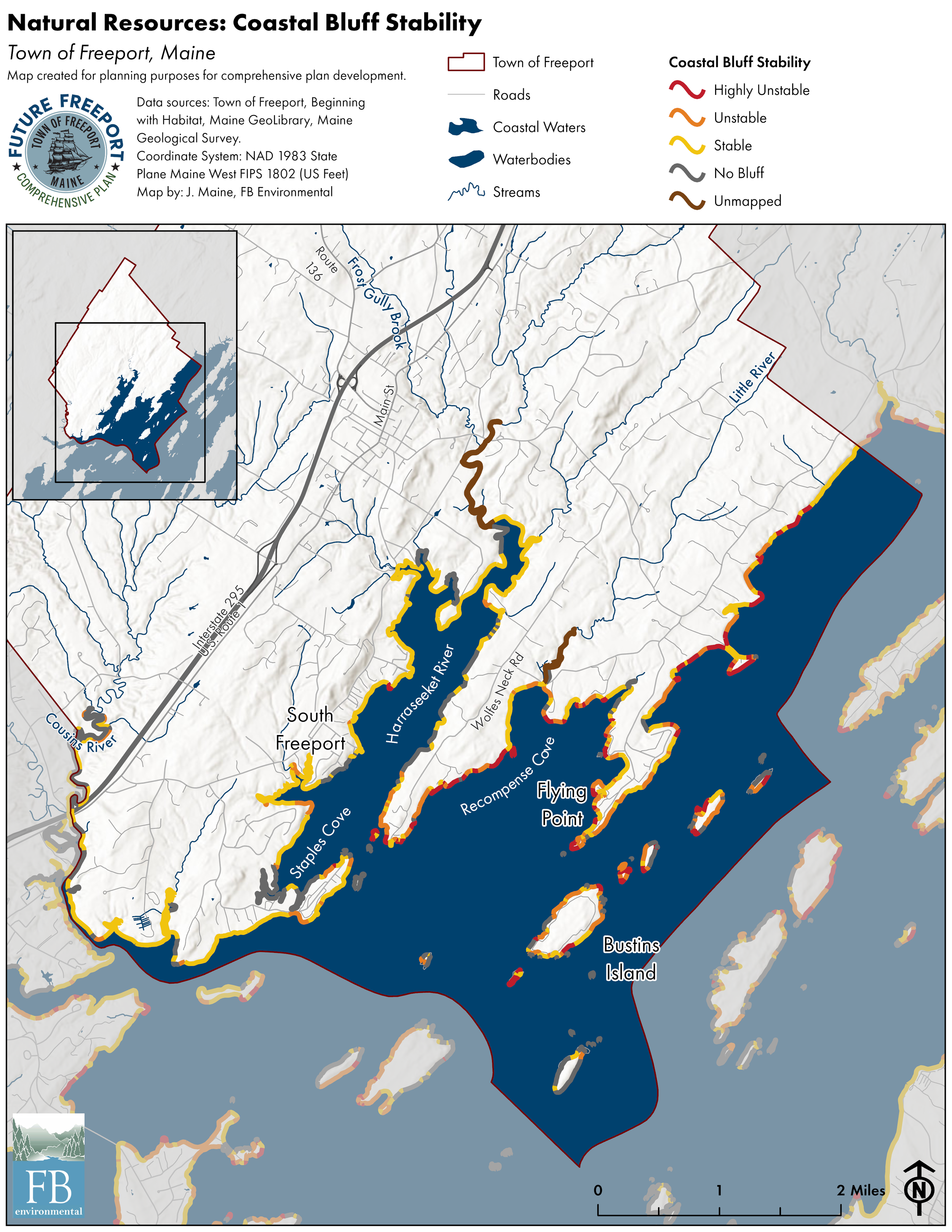
Coastal Bluff Stability

Natural Resources - Conserved Lands
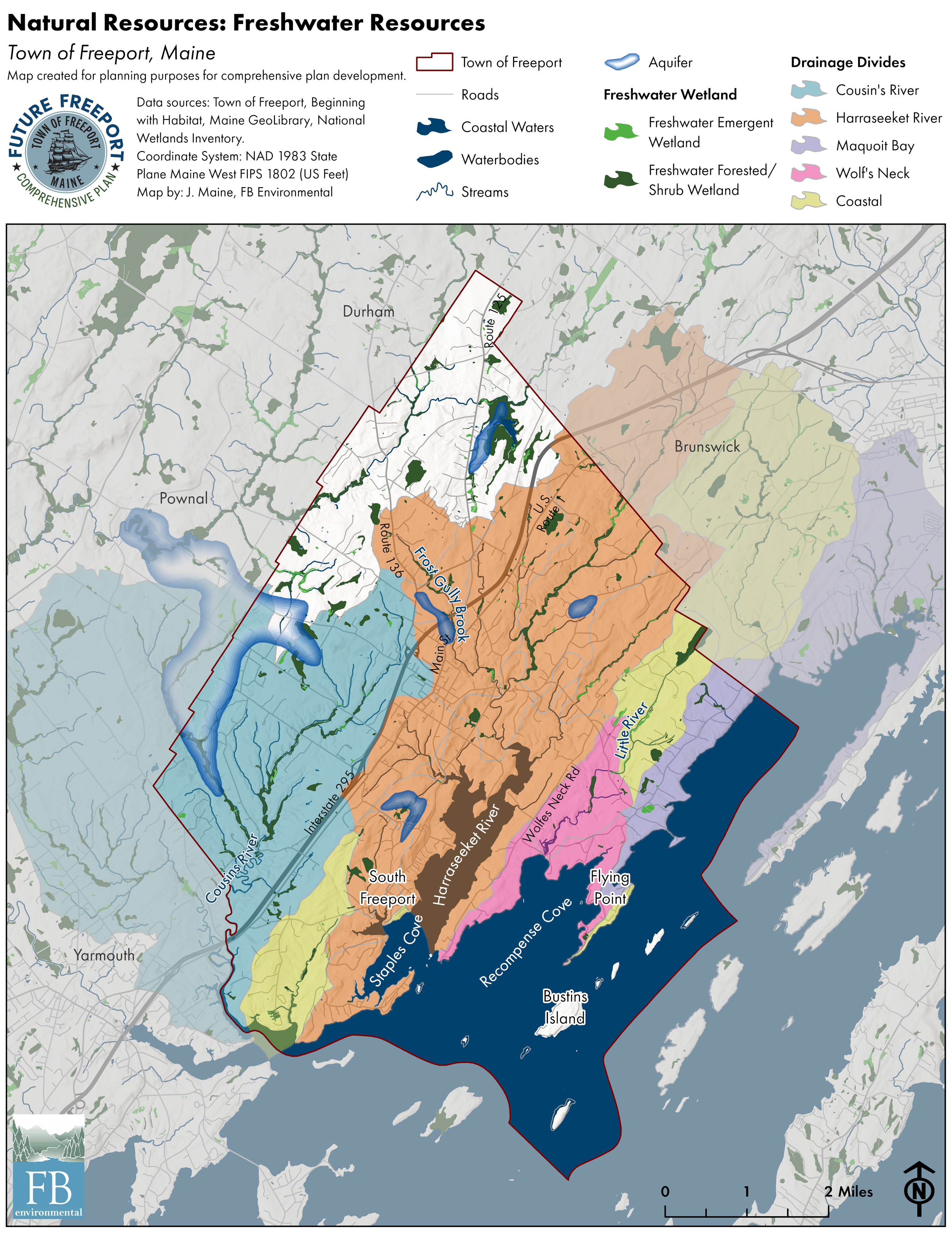
Freshwater Resources
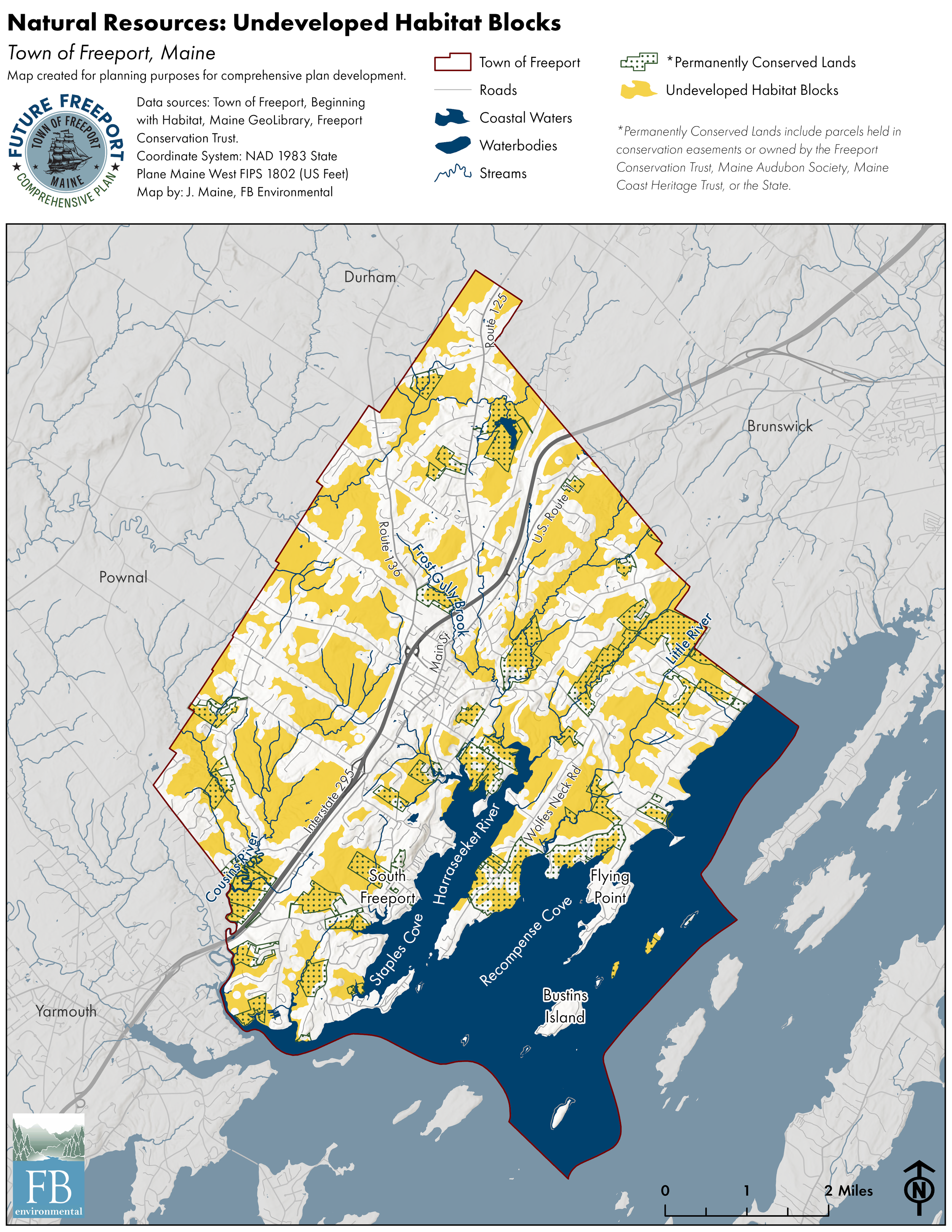
Undeveloped Habitat Blocks

Urban Impaired Watersheds

Wildlife Habitat

Public Facilities

Sewer Infrastructure

Stormwater

Water Infrastructure

Recreation Assets

Recreation Trails

Bike/Pedestrian Infrastructure

Road and Bridge Condition

Crash Locations
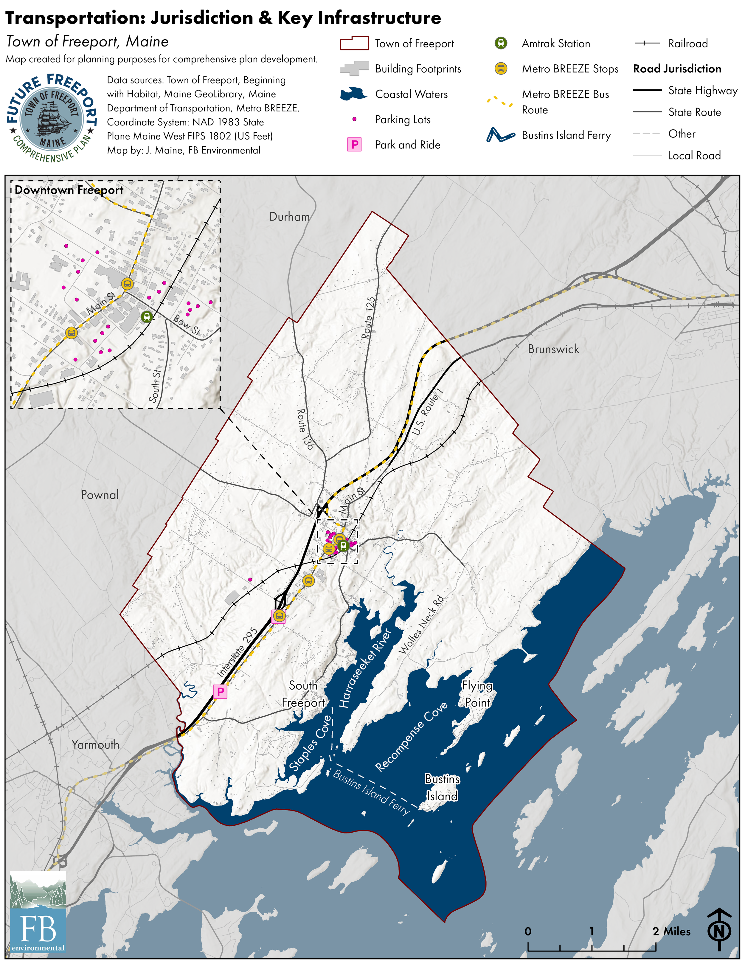
Transportation Jurisdiction & Key Infrastructure

Zoning Districts
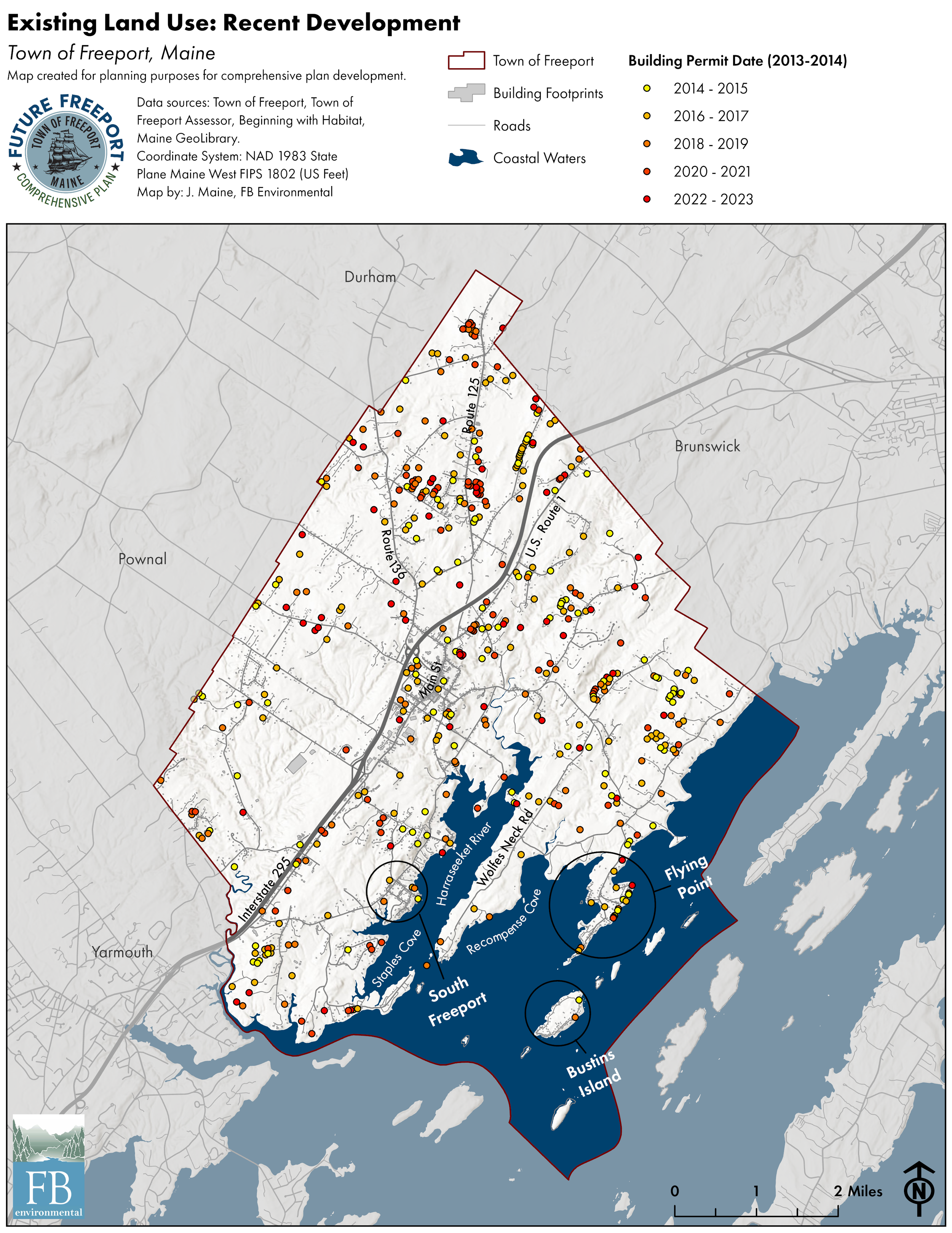
Existing Land Use: Recent Development